How To Do Hydrographic SurveyHow To Do Hydrographic Survey
 In this week’s edition of Shippers Guide, we take a look at hydrography, its importance, international obligations and the various methods of carrying out hydrographic survey.
The term hydrography is synonymously used to describe maritime cartography, which in the final stages of the hydrographic process uses the raw data collected through hydrographic survey into information usable by the end user.
Definition of Hydrography
The International Hydrographic Organization defines hydrography as “the branch of applied science which deals with the measurement and description of the physical features of the navigable portion of the earth’s surface [oceans, seas, coastal areas, lakes and rivers] and adjoining coastal areas, with special reference to their use for the purpose of navigation.”
Importance of Hydrography
In addition to supporting safe and efficient navigation of ships, hydrography underpins almost every other activity associated with the sea, including: resource exploitation – fishing, minerals, environmental protection and management, maritime boundary delimitation, national marine spatial data infrastructures, recreational boating, maritime defense and security, tsunami flood and inundation modeling, coastal zone management, tourism, marine science, etc.
International Obligations
In July 2002, the revised Chapter V of the IMO Safety of Life at Sea (SOLAS) Convention entered into force. Under the new Regulation 9, the Contracting Governments of SOLAS are now required to provide and maintain Hydrographic Services and products.
In the past few decades, the following important factors have emphasized the need for adequate hydrographic survey coverage and the production of nautical charts and publications as required by SOLAS Chapter V; the advent of exceptionally deep draught VLCC ships, the need to protect the marine environment, changing maritime trade patterns, the growing importance of seabed resources and the U.N. Law of the Sea Convention affecting areas of national jurisdiction.
Many charts which were adequate a decade ago may have to be recompiled using new survey data, collected to a higher degree of accuracy and providing improved coverage. This deficiency may not be limited to sparsely surveyed waters of developing nations, but may also apply to the coastal waters of major industrial states. The advent of accurate satellite navigation has made poorly positioned historical data an even greater problem for navigators. Fortunately, new survey technologies have improved the precision to which modern hydrographic surveys can be conducted.
United Nations View on Hydrography
On 23 December 2003, the United Nations General Assembly adopted Resolution A/RES/58/240 on Oceans and Law of the Sea that dealt, in large part, with safety of navigation. In this resolution, the General Assembly:
(a) Welcomes the work of the International Hydrographic Organization (IHO) and its 14 Regional Hydrographic Commissions and encourages increased membership of the IHO by States, noting that organization’s capacity to provide technical assistance, facilitate training and identify potential funding sources for development or improvement of hydrographic services; and calls upon States and agencies to support the IHO trust fund and examine the possibility of partnerships with the private sector;
(b) Invites IHO and the International Maritime Organization (IMO) to continue efforts and to jointly adopt measures with a view to encouraging greater international cooperation and coordination for the transition to electronic nautical charts; and to increase the coverage of hydrographic information on a global basis, especially in areas of international navigation and ports and where there are vulnerable or protected marine areas;
(c) Encourages intensified efforts to build capacity for developing countries, in particular for the east developed countries, small island developing States and coastal African States, to improve hydrographic services and the production of nautical charts, including the mobilization of resources and building of capacity with support from international financial institutions and the donor community, recognizing that economics of scale can apply in some instances at the regional level through shared facilities, technical capabilities and information for the provision of hydrographic services and the preparation of and access to nautical charts.
Hydrography in Nigeria
In Nigeria, the Nigerian Inland Waterways Authority (NIWA) is responsible for hydrological and hydrographic surveys, river chart production and cartography, river mapping, aerial survey. We provide hydraulic structures for river dams, bed and bank stabilization, barrages and groynes; install and maintain lights, buoys and all navigational aids along all water channels and banks.
Methods of Hydrographic Survey
Hydrography is collected under rules which vary depending on the acceptance authority. Traditionally conducted by ships with a sounding line or echo sounding, surveys are increasingly conducted with the aid of aircraft and sophisticated electronic sensor systems in shallow waters.
Lead Lines, Sounding Poles, and Single-Beam Echosounders
The history of hydrographic surveying dates almost as far back as that of sailing. For many centuries, a hydrographic survey required the use of lead lines – ropes or lines with depth markings attached to lead weights to make one end sink to the bottom when lowered over the side of a ship or boat – and sounding poles, which were poles with depth markings which could be thrust over the side until they touched bottom. In either case, the depths measured had to be read manually and recorded, as did the position of each measurement with regard to mapped reference points as determined by three-point sextant fixes. The process was labor-intensive and time-consuming and, although each individual depth measurement could be accurate, even a thorough survey as a practical matter could include only a limited number of sounding measurements relative to the area being surveyed, inevitably leaving gaps in coverage between single soundings.
Single-beam echosounders and fathometers began to enter service in the 1930s which used sonar to measure the depth beneath a vessel. This greatly increased the speed of acquiring sounding data over that possible with lead lines and sounding poles by allowing information on depths beneath a vessel to be gathered in a series of lines spaced at a specified distance. However, it shared the weakness of earlier methods by lacking depth information for areas in between the strips of sea bottom the vessel sounded.
Wire-Drag Surveying
In 1904, wire-drag surveys were introduced into hydrography, and the U.S. Coast and Geodetic Survey’s Nicholas H. Heck played a prominent role in developing and perfecting the technique between 1906 and 1916. In the wire-drag method, a wire attached to two ships or boats and set at a certain depth by a system of weights and buoys was dragged between two points. If the wire encountered an obstruction, it would become taut and form a “V” shape. The location of the “V” revealed the position of submerged rocks, wrecks, and other obstructions, while the depth at which the wire was set showed the depth at which the obstruction was encountered. This method revolutionized hydrographic surveying, as it allowed a quicker, less laborious and far more complete survey of an area than did the use of lead lines and sounding poles.
Prior to the advent of sidescan sonar, wire-drag surveying was the only method for searching large areas for obstructions and lost vessels and aircraft.[15] So valuable was wire-drag surveying in the United States that for decades the U.S. Coast and Geodetic Survey, and later the National Oceanic and Atmospheric Administration, fielded a pair of sister ships of identical design specifically to work together on such surveys. USC&GS Marindin and USC&GS Ogden conducted wire-drag surveys together from 1919 to 1942, USC&GS Hilgard (ASV 82) and USC&GS Wainwright (ASV 83) took over from 1942 to 1967, and USC&GS Rude (ASV 90) (later NOAAS Rude (S 590) and USC&GS Heck (ASV 91) (later NOAAS Heck (S 591) worked together on wire-drag operations from 1967.
The rise of new electronic technologies -sidescan sonar and multibeam swath systems – in the 1950s, 1960s and 1970s eventually made the wire-drag system obsolete. Sidescan sonar could create images of underwater obstructions with the same fidelity as aerial photography, while multibeam systems could generate depth data for 100 percent of the bottom in a surveyed area. These technologies allowed a single vessel to do what wire-drag surveying required two vessels to do, and wire-drag surveys finally came to an end in the late 1980s. Vessels were freed from working together on wire-drag surveys, and in NOAA, for example, Rude and Heck operated independently in their later years.
Modern Surveying
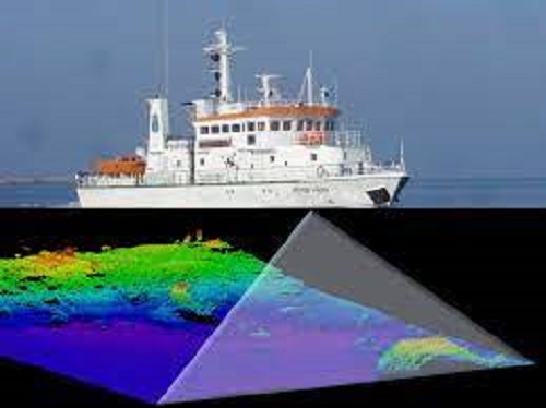
In suitable shallow-water areas lidar (light detection and ranging) may be used.[21] Equipment can be installed on inflatable craft, such as Zodiacs, small craft, autonomous underwater vehicles (AUVs), unmanned underwater vehicles (UUVs) or large ships, and can include sidescan, single-beam and multibeam equipment. At one time different data collection methods and standards were used in collecting hydrographic data for maritime safety and for scientific or engineering bathymetric charts, but increasingly, with the aid of improved collection techniques and computer processing, the data is collected under one standard and extracted for specific use.
After data is collected, it has to undergo post-processing. A massive amount of data is collected during the typical hydrographic survey, often several soundings per square foot. Depending on the final use intended for the data (for example, navigation charts, Digital Terrain Model, volume calculation for dredging, topography, or bathymetry) this data must be thinned out. It must also be corrected for errors (i.e., bad soundings) and for the effects of tides, waves/heave, water level and thermoclines (water temperature differences). Usually the surveyor has additional data collection equipment on site to record the data required for correcting the soundings. The final output of charts can be created with a combination of specialty charting software or a computer-aided design (CAD) package, usually Autocad.
With crowd-sourced surveying, although the accuracy of the individual measurements are not as accurate as with a traditional survey, the algorithms used rely on a high data density to produce final results that are more accurate than single measurements. A comparison of crowd-sourced surveys with multibeam surveys indicates an accuracy of crowd-sourced surveys of around plus or minus 0.1 to 0.2 meter (about 4 to 8 inches).
In a nutshell, hydrographic surveying looks into the ocean to see what the sea floor looks like.
